
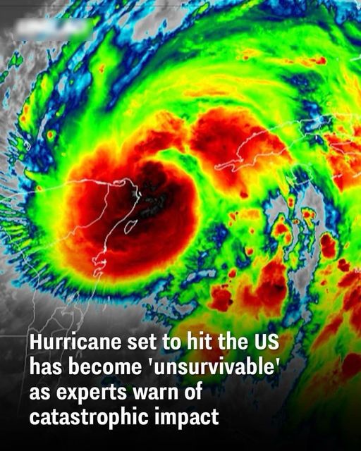
An unusually powerful hurricane is drawing serious attention as it advances toward the United States. Hurricane Rafael, a rare November storm, has rapidly intensified and is now classified as a Category 2 system, with sustained winds around 110 miles per hour. Storms of this strength are uncommon so late in the season, which has heightened concern among meteorologists and emergency planners, especially for communities along the Gulf Coast.
The first step in assessing the risk is understanding where the storm is headed. Current forecasts show western Cuba directly in Rafael’s path, with landfall expected in the near term. From there, the storm is projected to move northward, placing regions from Texas to the Florida Panhandle under increased watch. Experts warn that the storm’s strength, combined with warm waters, could lead to rapid changes in intensity, making preparation critical even before final tracks are confirmed.
Another key factor is timing. Late-season hurricanes often catch people off guard, as many assume the most dangerous part of hurricane season has passed. However, Rafael’s development highlights how conditions can still support powerful storms well into November. High winds, heavy rainfall, and the potential for storm surge are all concerns, particularly in coastal and low-lying areas that may not be fully prepared for a major event this late in the year.
The most important step for residents in potentially affected regions is staying informed and ready to act. Following updates from trusted sources such as the National Hurricane Center, reviewing evacuation plans, and securing property can make a significant difference. While forecasts will continue to evolve, early awareness and preparation remain the strongest tools against a storm that experts say could have severe and potentially catastrophic impacts if it maintains its current strength.